Trail
Băile Tușnad – Lacul Sfânta Ana
The hike from Băile Tușnad to Saint Anne's Lake (Lacul Sfânta Ana) takes you to the only volcanic lake in Romania, cradled in the crater of an extinct volcano in the Harghita–Covasna Mountains. It is an easy outing through dense forest, suitable for families and beginners, with the option to visit the nearby Mohoș peat bog.
The figures are indicative: roughly 1 hour 15 minutes one way, +~300 m elevation gain, blue stripe waymark. Real time depends on pace and how long you pause; the forest climb is steady, with no technical sections.
On the trail
You set off from Băile Tușnad (~650 m), in the resort, following the blue stripe waymark toward the lake on a well-trodden forest path.
- Start (Băile Tușnad). Pick up the blue stripe at the edge of the resort. The path climbs steadily through deciduous and spruce forest, shady and cool.
- The forest climb. The most demanding part of the outing — a steady gradient with no wide views, but pleasant in heat. There are usually no safe water sources, so carry your own.
- The saddle / Mohoș junction. Near the Saint Anne crater the path nears the ridge road; from here you can optionally take a side route to the Mohoș peat-bog reserve, the former twin crater now turned into a bog.
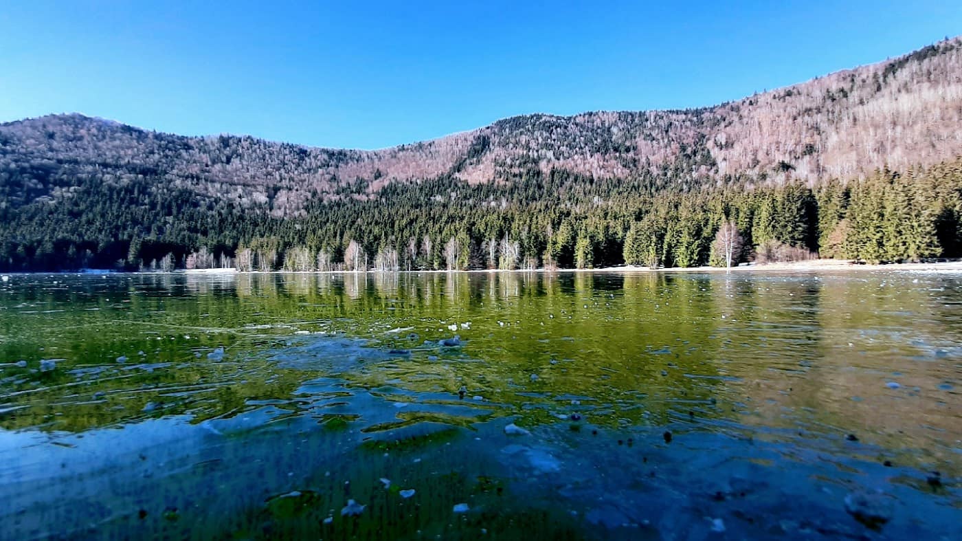
- Saint Anne's Lake. A short descent into the volcanic crater to the lakeshore — clear water ringed by forest, a unique landmark in Romania. The area is protected: stay on the path and leave no litter.
The lake belongs to the Harghita–Covasna region, and the sight itself: Saint Anne's Lake. From here you can explore other trails or find lodging at guesthouses. For driving access, see the area's roads.
Equipment and difficulty
Difficulty easy, but a mountain climb through forest — footwear and water make the difference.
- Mountain boots or trail shoes with a good sole (the path can be muddy and rooty after rain).
- An extra layer; in the forest and beside the lake it is cooler and damp.
- Water (at least 1–1.5 l) and snacks; do not rely on safe sources on the trail.
- A rain shell; mountain weather changes fast.
Details in the equipment guide.
Safety
It is an easy outing, but still in the mountains and through forest; treat it with care.
- CO₂ build-up (mofettes) — in this volcanic area gas emissions can collect in hollows; do not approach pits or zones marked as dangerous, and do not lie down in depressions.
- Fog — can hide the blue stripe waymark in the forest; follow the trodden path and do not improvise shortcuts.
- Changeable weather — rain makes the path slippery; in a storm avoid open ground on the ridge.
Retreat option: if the weather turns or the children tire, the return to Băile Tușnad is short and clearly marked on the blue stripe. Turn back in good time. Check the weather and the safety guide.
Emergencies: 112 (Mountain Rescue / Salvamont).
⚠ Indicative trail data. Mountain weather changes fast — check the forecast, markings and conditions before you set off. Tell someone your route.
Trail map
Indicative topographic map (OpenTopoMap) — it shows the terrain and the marked paths. Download the route offline and don't rely on signal on the ridge.
Plan your trip
Everything you need for the mountains
Affiliate content: bookings through these offers may earn us a commission, at no extra cost to you.
Stays in the area
Stays nearby
Compare stays available near this place, on the map.
Accommodation map by Stay22 · indicative prices. Bookings through the map may earn a commission, at no extra cost to you.
Frequently asked questions about the Băile Tușnad – Lacul Sfânta Ana trail
How long does the Băile Tușnad – Lacul Sfânta Ana trail take?
The stated duration is indicative and depends on your pace, breaks and the weather. Start early and leave enough time to return before dark.
What gear do I need?
Grippy boots, clothing layers, a rain shell, water, food, an offline map/app and a head torch. At altitude, pack a warm layer even in summer.
Is the Băile Tușnad – Lacul Sfânta Ana trail safe?
With preparation and good weather, yes. Check the forecast, tell someone your route, turn back if the weather worsens and save the emergency number 112 (mountain rescue). Ridge routes require experience.