Trail
Creasta Munților Făgăraș
The Făgăraș Ridge Traverse is the great crossing of the Southern Carpathians — an expert-level, multi-day route on the red stripe marker, running end to end along the highest ridge in Romania. Along the way you bag both 2500 m summits, Moldoveanu (2544 m) and Negoiu (2535 m), plus dozens of saddles, glacial lakes and remote refuges. This is an alpine expedition, not a day hike, in the Făgăraș Mountains.
Figures are indicative: the full traverse is ~70 km of ridge, usually done in 4–6 days depending on pace, weather and chosen endpoints. Classically you start at Plaiul Foii (or Turnu Roșu) and exit toward Zârna or Suru, but direction and staging vary. Treat all numbers as references and plan day by day, with buffers.
On the trail
The guiding line is the red stripe, which follows the main crest end to end. Check the exact marking and refuge condition locally before you set out — many are small and fill fast.
- Western end (Plaiul Foii / Suru). Climb from the valley to the main ridge through forest, then open alpine terrain. Early stages pass the Suru refuge and springs at the valley heads.
- Central section — Negoiu. The ridge sharpens toward Negoiu Peak, with key passages such as Strunga Dracului and Custura Sărății, exposed and rocky. Indicative refuges: Negoiu, around Caltun, by the lake of the same name.
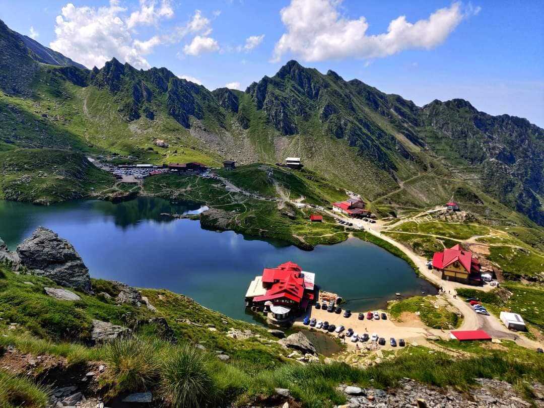
- Bâlea area. A possible resupply and retreat point toward the Transfăgărășan; usually where you top up water and food.
- Toward Moldoveanu. The crown stage climbs Moldoveanu, accessible from Cabana Podragu and the Orzănelei saddle. See Moldoveanu Peak.
- Eastern end (Zârna / Iezer). The ridge drops gradually toward the indicative Berevoescu refuge and the Iezer area, then into the valley to Zârna.
Water usually comes from the glacial lakes and springs below the crest — there are no reliable sources on the ridge itself. Descents to huts/refuges follow only the connecting markers.
Equipment and difficulty
Expert difficulty, owing to length, sustained altitude and multi-day exposure.
- Long-haul pack, tent/sleeping bag (refuges don't guarantee a spot), stove.
- Stiff boots, helmet for the key passages (Strunga Dracului, Custura Sărății).
- Large water capacity + purification method — you refill from lakes.
- Insulation, hardshell, gloves, headlamp, map/GPS, compass, first aid.
- A day-by-day plan with retreat points and food reserve.
See the Făgăraș safety guide and access roads info.
Safety
On the Făgăraș ridge you are exposed for days; weather and isolation are the major risks.
- Exposed passages — Strunga Dracului and Custura Sărății have rocky sections, cabled in places; do not tackle them on wet rock or in dense fog.
- Severe weather — afternoon storms, wind and hail are common in summer; in winter the ridge is expedition terrain. Check the weather daily.
- Scree and rockfall — helmet and sure footing on the rocky descents.
- Isolation — between endpoints you can be hours from any help; travel in a group and log your route.
- Residual snow — hard snow tongues can linger in saddles into late summer.
When to turn back: if the weather breaks, you fall behind schedule, or a group member fails, descend the nearest connecting marker to a hut/refuge. Don't force the key passages in bad weather. Read the mountain safety and weather guide.
Emergencies: 112 (Salvamont).
⚠ Indicative trail data. Mountain weather changes fast — check the forecast, markings and conditions before you set off. Tell someone your route.
Trail map
Indicative topographic map (OpenTopoMap) — it shows the terrain and the marked paths. Download the route offline and don't rely on signal on the ridge.
Plan your trip
Everything you need for the mountains
Affiliate content: bookings through these offers may earn us a commission, at no extra cost to you.
Stays in the area
Stays nearby
Compare stays available near this place, on the map.
Accommodation map by Stay22 · indicative prices. Bookings through the map may earn a commission, at no extra cost to you.
Frequently asked questions about the Creasta Munților Făgăraș trail
How long does the Creasta Munților Făgăraș trail take?
The stated duration is indicative and depends on your pace, breaks and the weather. Start early and leave enough time to return before dark.
What gear do I need?
Grippy boots, clothing layers, a rain shell, water, food, an offline map/app and a head torch. At altitude, pack a warm layer even in summer.
Is the Creasta Munților Făgăraș trail safe?
With preparation and good weather, yes. Check the forecast, tell someone your route, turn back if the weather worsens and save the emergency number 112 (mountain rescue). Ridge routes require experience.