Trail
Păltiniș – Vârful Cindrel
The route from Păltiniș to Cindrel Peak (2244 m) is a moderate tour across the bare, gentle plateaus of the Cindrel Mountains, passing the glacial lakes Iezerul Mare and Iezerul Mic. Starting from the highest mountain resort in Romania, you climb smooth ridges with no technical passages, but over a respectable distance that demands pace and water. It is an accessible tour, ideal for anyone who wants altitude without severe alpine exposure.
Figures are indicative: reckon ~3.5 hours of climbing and +~700 m of gain, depending on pace and weather. You'll find water at springs and around the lakes, but don't rely on it untreated. Treat the numbers as references.
On the trail
You set off from Păltiniș on the red stripe toward the Cindrel plateau. Check the exact marking locally, especially at junctions.
- Start (Păltiniș). You climb from the resort on a forest road and path through spruce forest, on a gentle grade.
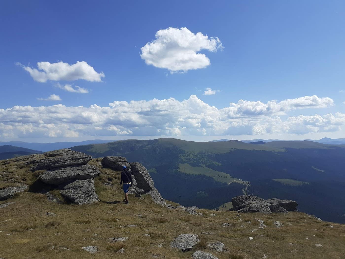
- Onto the plateau. The forest thins and you emerge onto the bare, gentle plateaus typical of the Cindrel — open grassy terrain with long walking.
- The Iezer lakes. Along the way the view opens to Iezerul Mare and Iezerul Mic, glacial lakes in the cirques below the ridge; springs nearby.
- Toward the summit. The last segment climbs gently across the plateau to the peak, with no technical passages, but long and wind-exposed.
- Cindrel Peak (2244 m). The highest point of the massif, with a wide-open panorama toward the Făgăraș and Lotru.
The descent usually follows the same route back to Păltiniș; the tour is long, so leave early.
Equipment and difficulty
Moderate difficulty, mainly from the length and the wind exposure on the plateau.
- Comfortable boots with good grip — grassy and rocky terrain.
- Water for the tour (1.5–2 l) + a way to refill at springs.
- Insulation + hardshell — the wind on the plateau is constant.
- Headlamp, map/GPS, basic first aid.
- Fitness for a long tour, but with no technical difficulties.
See info on guesthouses in the Păltiniș area and access roads.
Safety
A gentle, accessible route, but long and exposed, where weather and navigation on the plateau matter.
- Wind and cold — the bare plateau is exposed; wind drops the felt temperature fast.
- Fog — on the broad plateaus, poor visibility makes it easy to lose direction; carry a map/GPS.
- Changeable weather — afternoon storms reach here too; start early. Check the weather.
- Distance — the tour is longer than it looks; account for the return time.
- Residual snow — snow can linger in the Iezer cirques early in the season.
When to turn back: if dense fog sets in or the weather breaks on the plateau, head back to Păltiniș while you are still on a known bearing. Read the mountain safety and weather guide.
Emergencies: 112 (Salvamont).
⚠ Indicative trail data. Mountain weather changes fast — check the forecast, markings and conditions before you set off. Tell someone your route.
Trail map
Indicative topographic map (OpenTopoMap) — it shows the terrain and the marked paths. Download the route offline and don't rely on signal on the ridge.
Plan your trip
Everything you need for the mountains
Affiliate content: bookings through these offers may earn us a commission, at no extra cost to you.
Stays in the area
Stays nearby
Compare stays available near this place, on the map.
Accommodation map by Stay22 · indicative prices. Bookings through the map may earn a commission, at no extra cost to you.
Frequently asked questions about the Păltiniș – Vârful Cindrel trail
How long does the Păltiniș – Vârful Cindrel trail take?
The stated duration is indicative and depends on your pace, breaks and the weather. Start early and leave enough time to return before dark.
What gear do I need?
Grippy boots, clothing layers, a rain shell, water, food, an offline map/app and a head torch. At altitude, pack a warm layer even in summer.
Is the Păltiniș – Vârful Cindrel trail safe?
With preparation and good weather, yes. Check the forecast, tell someone your route, turn back if the weather worsens and save the emergency number 112 (mountain rescue). Ridge routes require experience.