Trail
Poiana Brașov – Vârful Postăvaru
The route from Poiana Brașov to Postăvaru Peak (1799 m) is the classic climb up the mountain that towers over Brașov: a moderate outing through forest to a ridge with a wide view towards Piatra Craiului and the Bucegi. The big advantage is the cable car from Poiana Brașov, which serves as an alternative way up or as a retreat option.
Figures are approximate: roughly 2.5 hours of climbing, +~750 m of gain, waymarked with a red triangle. Real time depends on your pace and the weather — on the forest path, rain brings mud and slippery stones.
On the trail
You start from Poiana Brașov (~1020 m), at the resort, following the red triangle towards the ridge, climbing through forest.
- Start (Poiana Brașov). Pick up the red triangle at the edge of the resort. A gentle start, then a steady climb through dense beech and spruce forest.
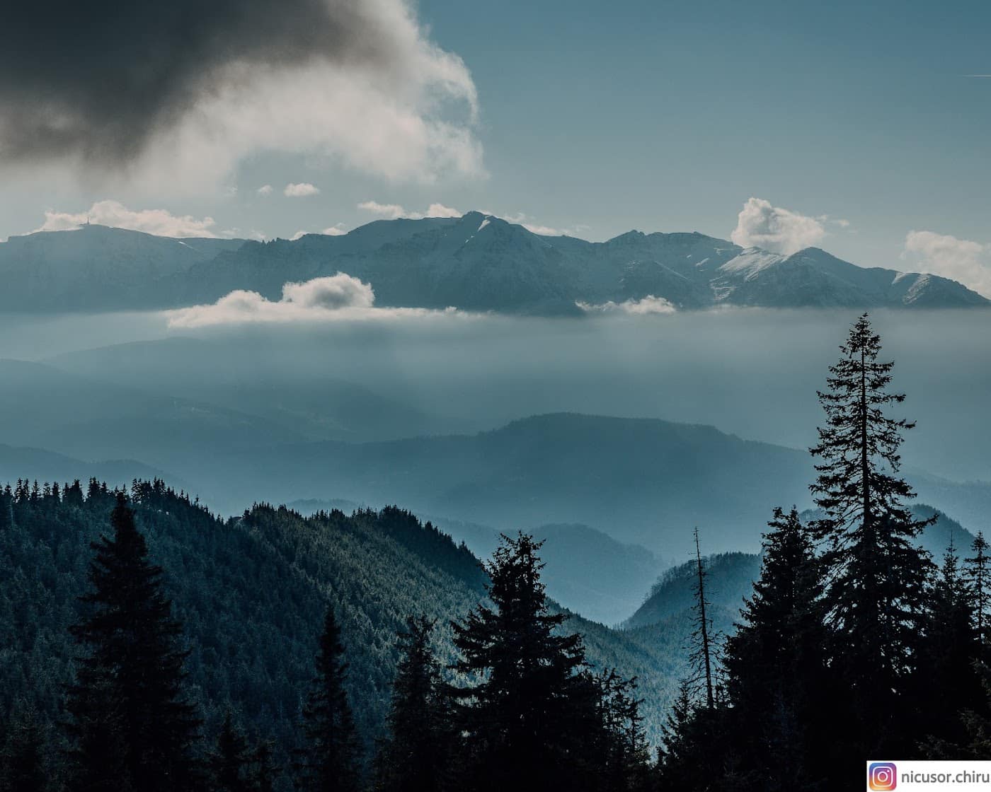
- The forest climb. The longest part — a shady path with switchbacks and root steps. It is usually cool even in summer; muddy after rain.
- Cabana Postăvarul. A key orientation and rest point on the ridge (~1580 m), beside the upper cable-car station. It usually offers shelter and a place to pause; check hours locally.
- The final ridge. From the cabin you climb the last stretch to the summit, on more open and rocky ground. The first wide views appear.
- Postăvaru Peak (1799 m). A panorama over Brașov, Piatra Craiului, the Bucegi and the Prahova valley. A good spot to rest before descending.
You can descend on the same trail, by cable car, or combine it with other outings in the Brașov – Poiana Brașov area. In winter, Poiana is the main ski domain — see Poiana Brașov. See also the guesthouses in the area.
Equipment and difficulty
Difficulty is moderate — a sustained climb but no technical sections; accessible to fit families too.
- Mountain boots with good grip (the forest path is slippery when wet).
- Thermal layer and a rain shell — the ridge is colder and windier than the resort.
- Water (1.5–2 l), snacks; do not count on reliable water sources along the way.
- Map / GPS for fog on the ridge.
See the equipment guide for details.
Safety
Up to the cabin the trail is sheltered by forest; on the ridge the altitude hazards appear:
- Fog — on the open ridge you lose your bearings; follow the red triangle and carry navigation tools.
- Mud and slippery stones — in rain the descent through the forest demands careful footing.
- Lightning — the ridge is exposed; in a storm retreat towards the forest or the cabin.
Retreat option: the big advantage is the cable car from Poiana Brașov — if the weather turns or you tire, you can descend from the upper station (check hours and whether it is running locally). Turn back in good time and do not climb to the ridge in thick fog. Check the weather and the safety guide.
Emergencies: 112 (Mountain Rescue / Salvamont).
⚠ Indicative trail data. Mountain weather changes fast — check the forecast, markings and conditions before you set off. Tell someone your route.
Trail map
Indicative topographic map (OpenTopoMap) — it shows the terrain and the marked paths. Download the route offline and don't rely on signal on the ridge.
Plan your trip
Everything you need for the mountains
Affiliate content: bookings through these offers may earn us a commission, at no extra cost to you.
Stays in the area
Stays nearby
Compare stays available near this place, on the map.
Accommodation map by Stay22 · indicative prices. Bookings through the map may earn a commission, at no extra cost to you.
Frequently asked questions about the Poiana Brașov – Vârful Postăvaru trail
How long does the Poiana Brașov – Vârful Postăvaru trail take?
The stated duration is indicative and depends on your pace, breaks and the weather. Start early and leave enough time to return before dark.
What gear do I need?
Grippy boots, clothing layers, a rain shell, water, food, an offline map/app and a head torch. At altitude, pack a warm layer even in summer.
Is the Poiana Brașov – Vârful Postăvaru trail safe?
With preparation and good weather, yes. Check the forecast, tell someone your route, turn back if the weather worsens and save the emergency number 112 (mountain rescue). Ridge routes require experience.