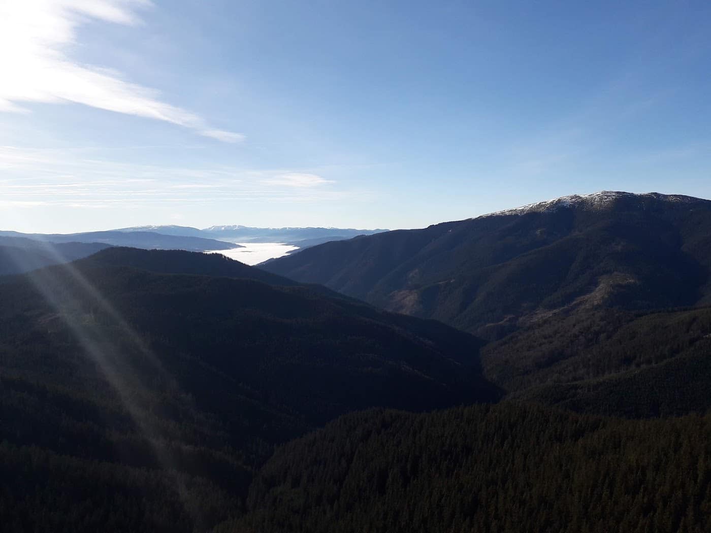
The Retezat Mountains are the wilderness reservoir of the Romanian Carpathians: a massif with more than 80 glacial lakes, the country's oldest national park, and a density of summits above 2000 m that takes your breath away. You don't come here for cable cars and terraces, but for the silence of the glacial cirques, for chamois on the slopes, and for nights under canvas beside the largest glacial lake in Romania. This guide to hiking in the Retezat shows you how to get in, where to walk, and what rules you respect in a real national park.
To orient yourself, open the Retezat zone page and that of Retezat National Park, where you'll find the general framing of the protected area.
A national park, with rules to match
The Retezat is no ordinary mountain: it is a national park, with a strictly protected core (the Gemenele scientific reserve) where access is forbidden or tightly regulated. Being a protected area changes how you behave on the trail — it isn't merely common-sense advice, but a condition for the massif to remain what it is.
Basic rules you respect without exception: - Don't camp anywhere you like. Camping is allowed only in designated areas; near the glacial lakes the rules are strict precisely to protect the fragile shores. - Don't light fires outside permitted spots; alpine vegetation takes decades to recover. - Carry your rubbish out. Everything you take up, you bring down. Leave nothing. - Don't disturb the wildlife. The chamois, the marmots and the high-altitude birds are home here; you are the guest. - Stay on the paths. Trampled alpine meadows erode quickly.
Following these rules is what separates a mountain hiker from a Sunday tourist.
Camping at Bucura
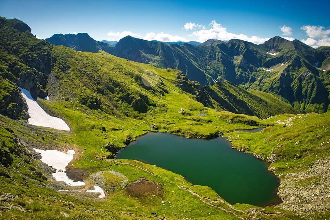
Lake Bucura, at about 2040 m, is the largest glacial lake in Romania and the logistical heart of the massif. The clearing beside it is the main designated camping area in the Retezat and the starting point for almost every important outing in the core of the park. In season it's crowded, especially on weekends, but it remains the natural base for exploring the lake region.
A few things to know about camping at Bucura: 1. Camp only in the designated zone, not on the lakeshore wherever you fancy. 2. The nights are cold even in summer — you're above 2000 m; a serious sleeping bag is essential. 3. The weather changes abruptly. Check the mountain weather forecast and keep a shell layer to hand. 4. Treat the water even when it looks crystal clear.
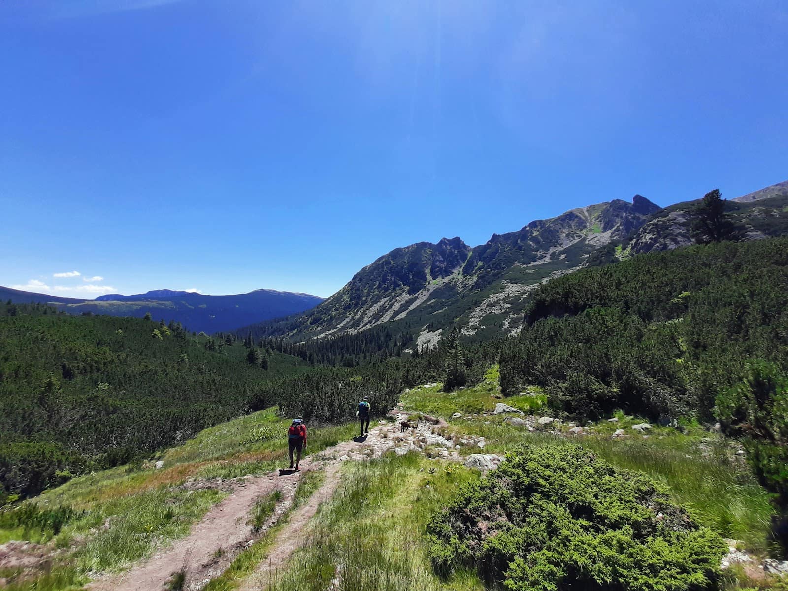
Bucura–Peleaga
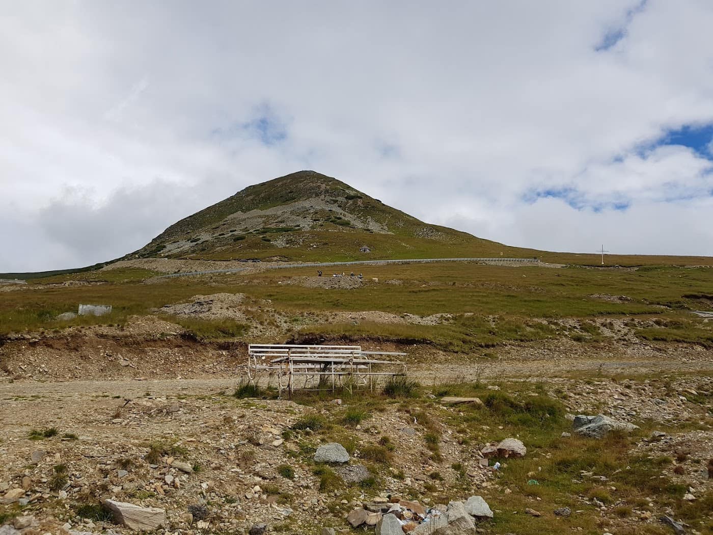
From Bucura starts one of the most loved routes in the massif, the climb to Peleaga Peak, 2509 m, the highest point of the Retezat. The route described on the Bucura–Peleaga page links the lake to the summit by a climb that, while not technically hard in good conditions, becomes demanding and exposed in wind, fog or wet terrain.
From Peleaga you get one of the most comprehensive panoramas of the massif — cirques, lakes and ridges as far as the eye can see. Remember that the times you find on maps are indicative: your real pace depends on fitness, pack weight and the state of the path. Start early to reach the summit before the afternoon storms, and always have an escape option.
The 80-plus glacial lakes
What makes the Retezat unique in the Carpathians is its density of glacial lakes: more than 80, scattered through the cirques carved by long-gone glaciers. Bucura is the largest by surface, but each lake has its own character — some wide and open, others hidden high up in cirques that are hard to reach.
For the hiker, the lakes aren't just scenery but also navigation markers and water sources (treated). A well-thought-out Retezat outing threads several lakes into a loop, with Bucura as the base. If you want broader context on their beauty, read our piece on the most beautiful glacial lakes.
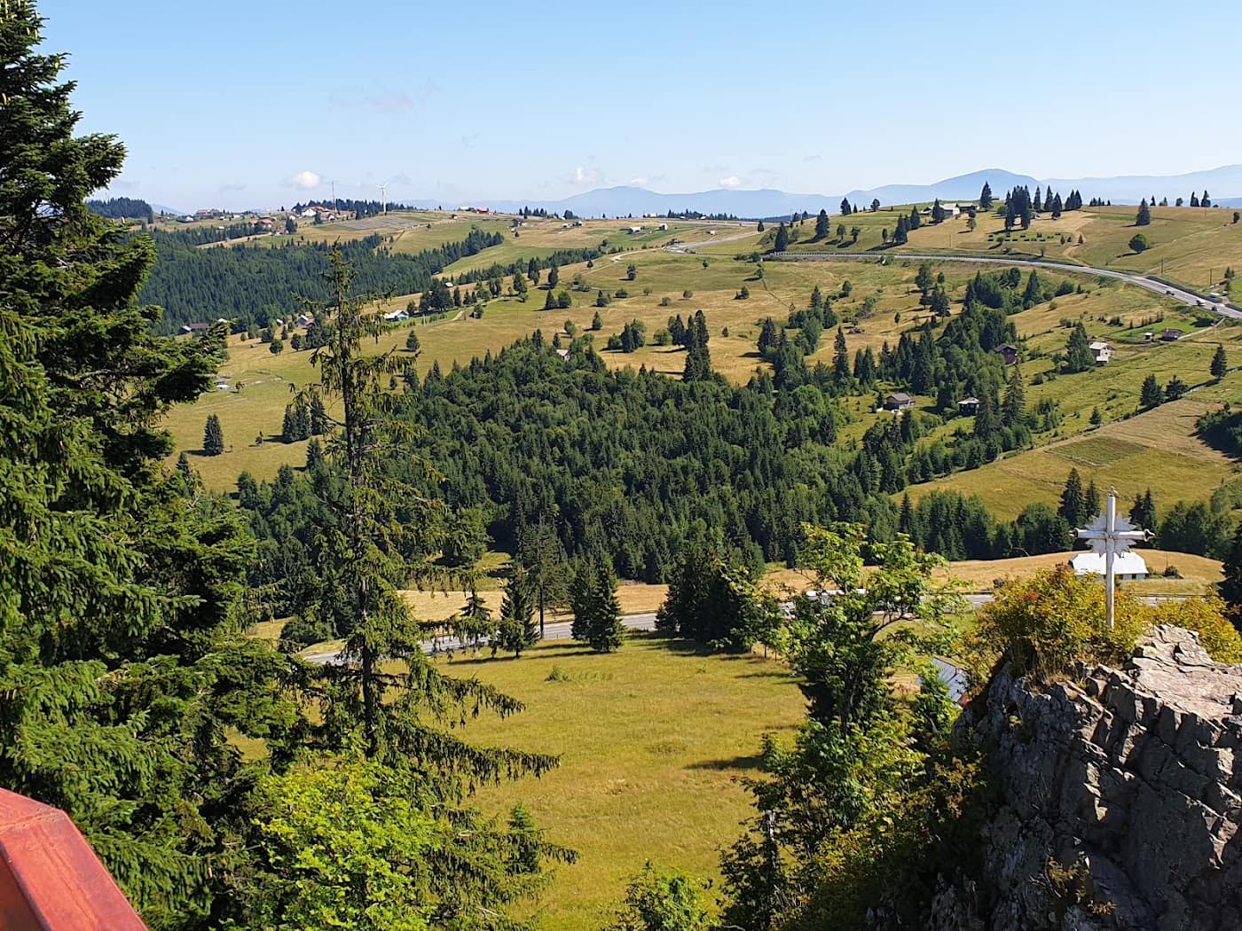
Access: Cârnic / Pietrele and Poiana Pelegii
You enter the Retezat on foot; there are no cable cars to spare you the climb. The two classic gateways are:
- Cârnic / Pietrele (northern access): the forest road climbs toward the Pietrele cabin, the classic base for outings in the north of the massif and for the climb to the lake region. Paths set off from here toward Bucura and the northern peaks.
- Poiana Pelegii (southern access): another established starting point, closer to the central lake region, much used for outings toward Bucura and Peleaga.
The access roads are forest tracks and can be in variable condition; find out about conditions before you set off and check the state of the roads. Whichever gateway you choose, the first day is usually the approach climb to the camping base.
Wildlife
The Retezat is one of the best places in Romania to see chamois and marmot in their natural environment, plus a rich high-altitude birdlife. The massif is also home to large carnivores, one more reason to behave responsibly: don't leave food within reach, don't feed the animals, and don't wander off the paths chasing wildlife.
Wildlife watching is done from a distance and in quiet. You're in an ecosystem that works precisely because people disturb it little — keep it that way.
When to go to the Retezat
The hiking season, as on all high ridges, is summer and early autumn: roughly July to September, when the snow has melted from the cirques and the high-altitude passages. In early summer, snow tongues can linger in the shaded cirques, which changes the difficulty. In winter and late spring, the Retezat becomes serious alpine terrain, with avalanche risk, reserved for those with winter experience and gear.
To choose the right window, see the guide on when to go to the mountains, by season, and for kit, the mountain hiking gear guide. Before any outing, re-read the mountain safety and weather guide. In an emergency, call 112 and ask for Salvamont (mountain rescue). If you want to build an objectives list, peaks above 2500 metres shows where Peleaga sits among the Carpathian giants.
Frequently asked questions
Where can I camp in the Retezat?
Camping is allowed only in designated areas, the main one being the clearing at Lake Bucura. Near the glacial lakes the rules are strict to protect the fragile shores. Don't camp anywhere you like and don't light fires outside permitted spots — the Retezat is a national park.
How hard is the Bucura–Peleaga route?
The climb from Bucura to Peleaga, 2509 m, isn't technically hard in good conditions, but becomes demanding and exposed in wind, fog or wet terrain. Map times are indicative. Start early to reach the summit before the storms and keep an escape option.
How do I reach the Retezat without a cable car?
You enter the Retezat on foot, through the classic gateways of Cârnic / Pietrele (north) or Poiana Pelegii (south). The access roads are forest tracks in variable condition, so check conditions and the state of the roads before you set off. The first day is usually the approach climb to the camping base.
How many glacial lakes does the Retezat have?
More than 80 glacial lakes, the highest density in the Carpathians, of which Bucura is the largest by surface in Romania. Many outings thread several lakes into a loop with Bucura as the base. See also our piece on the most beautiful glacial lakes.
When is the best time for hiking in the Retezat?
Summer and early autumn, roughly July to September, when the snow has melted from the cirques. In early summer, snow tongues can remain in the shaded cirques. In winter it becomes serious alpine terrain with avalanche risk — always check the weather and plan from the by-season guide.