Trail
Bâlea Lac – Lacul Capra
The hike from Bâlea Lac to Lake Capra is a short, beautiful alpine walk between two glacial lakes in the heart of the Făgăraș Mountains, reachable in summer straight off the Transfăgărășan. It is easy in terms of effort but quickly puts you in open alpine terrain with views of the main ridge — an ideal first taste of the Făgăraș.
The figures are rough estimates: about 1.5 hours, ~4 km and roughly +250 m of gain. On the ridge the weather changes everything, so treat the estimates as guidance. The route is usually only feasible in the warm season, when the Transfăgărășan is open.
On the trail
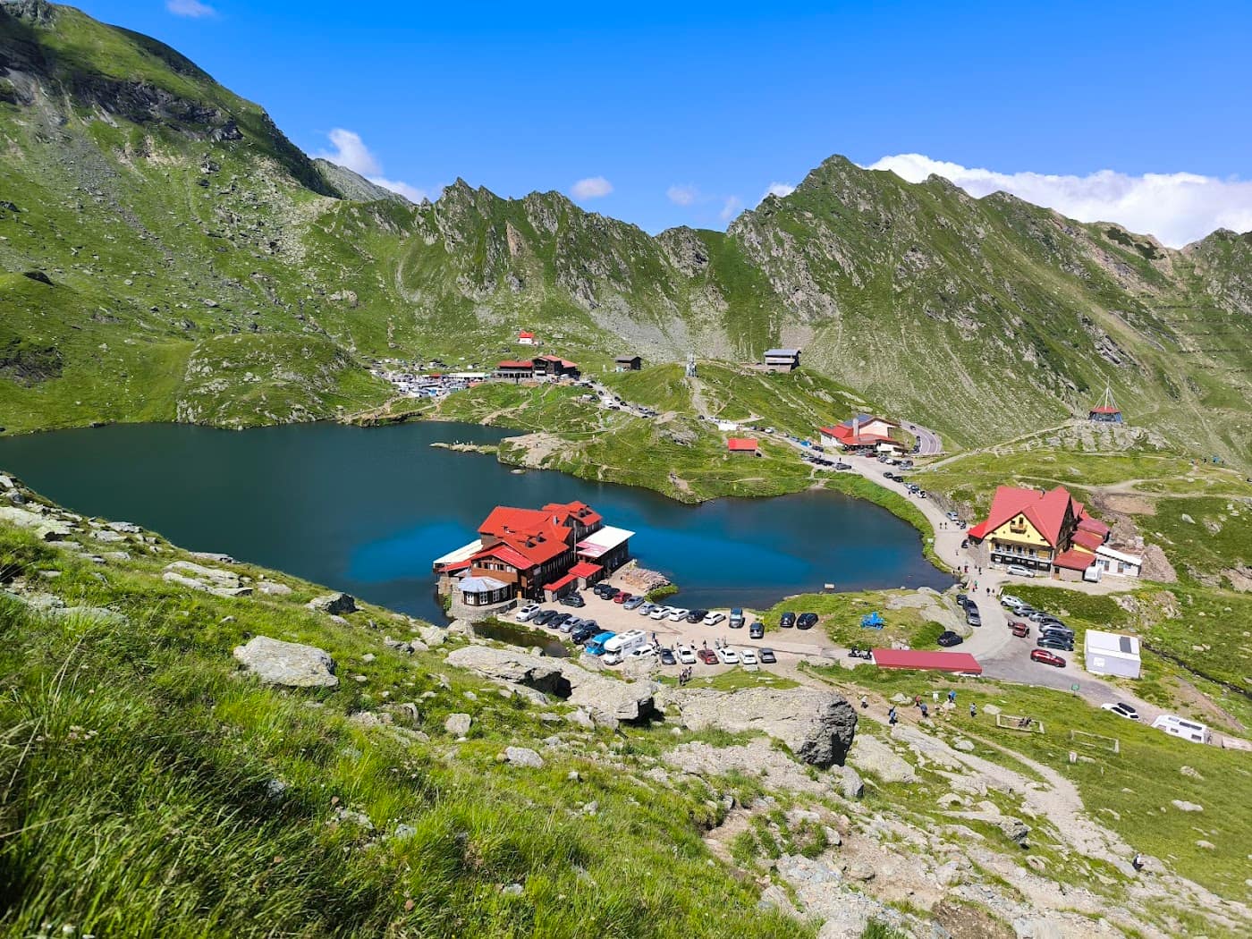
You start at Bâlea Lac (2034 m), beside the glacial lake and the chalet, following the blue stripe waymark southward.
- Start (Bâlea Lac). Pass Lake Bâlea and climb the path leaving the lake cirque toward the main ridge. The gradient is moderate, the ground rocky and grassy.
- Toward the Capra saddle. You climb gradually to the ridge zone, where the path crosses the saddle between the two cirques. From here the panorama opens toward the southern slope of the Făgăraș.
- Descent to Capra. From the ridge you drop into the southern cirque on the marked path, over open alpine terrain. Take care on rock, especially when wet.
- Lake Capra (~2230 m). You reach the shore of Lake Capra, a superb glacial lake, a classic rest and camping spot for those continuing along the ridge. The lake water is not drinkable without treatment.
The hike can be done as an out-and-back or as a segment of a longer Făgăraș ridge traverse.
Gear and difficulty
Difficulty is easy, but in an alpine environment above 2000 m.
- Boots with good grip — the ground is rocky and steep in places.
- A warm layer and a hard shell — at altitude, wind and cold arrive fast even in summer.
- Enough water (1.5 l+); do not rely on the lakes as a source without treatment.
- Sunglasses, sun protection, headlamp.
See the gear guide and check the roads for the state of the Transfăgărășan.
Safety
A short hike, but at altitude, where the weather is the deciding factor.
- Weather and lightning — on the open ridge you are very exposed to afternoon storms. Set off early and descend in good time. Check the weather.
- Fog — on the ridge, low visibility leads easily to disorientation; follow the waymarks carefully.
- Residual snow — early and late in the season, snow tongues may linger on the slopes; they can be hard and slippery.
- Access — the route depends on the Transfăgărășan being open; in winter this is serious winter-mountaineering terrain.
When to turn back: if storm clouds build or fog sets in, return by the same path to Bâlea. Also read the safety and weather guide.
Emergencies: 112 (Mountain Rescue / Salvamont).
⚠ Indicative trail data. Mountain weather changes fast — check the forecast, markings and conditions before you set off. Tell someone your route.
Trail map
Indicative topographic map (OpenTopoMap) — it shows the terrain and the marked paths. Download the route offline and don't rely on signal on the ridge.
Plan your trip
Everything you need for the mountains
Affiliate content: bookings through these offers may earn us a commission, at no extra cost to you.
Stays in the area
Stays nearby
Compare stays available near this place, on the map.
Accommodation map by Stay22 · indicative prices. Bookings through the map may earn a commission, at no extra cost to you.
Frequently asked questions about the Bâlea Lac – Lacul Capra trail
How long does the Bâlea Lac – Lacul Capra trail take?
The stated duration is indicative and depends on your pace, breaks and the weather. Start early and leave enough time to return before dark.
What gear do I need?
Grippy boots, clothing layers, a rain shell, water, food, an offline map/app and a head torch. At altitude, pack a warm layer even in summer.
Is the Bâlea Lac – Lacul Capra trail safe?
With preparation and good weather, yes. Check the forecast, tell someone your route, turn back if the weather worsens and save the emergency number 112 (mountain rescue). Ridge routes require experience.