A traverse of the Făgăraș Ridge is, for many Romanian hikers, the coming-of-age test of the mountains: five to seven days walking above 2000 m along the longest and highest alpine ridge in the Carpathians, with Moldoveanu (2544 m) and Negoiu (2535 m) strung on the same line. This is not a weekend walk dressed up as an expedition; it is an endurance route where weather, water and the decision to turn back matter far more than speed. This guide shows you how to plan a Făgăraș Ridge traverse without leaning on luck.
Before anything else, get the lay of the land: the Făgăraș and Transfăgărășan zone gives you the overview, while the Făgăraș Ridge trail page covers the main line we describe here.
What a Făgăraș Ridge traverse actually involves
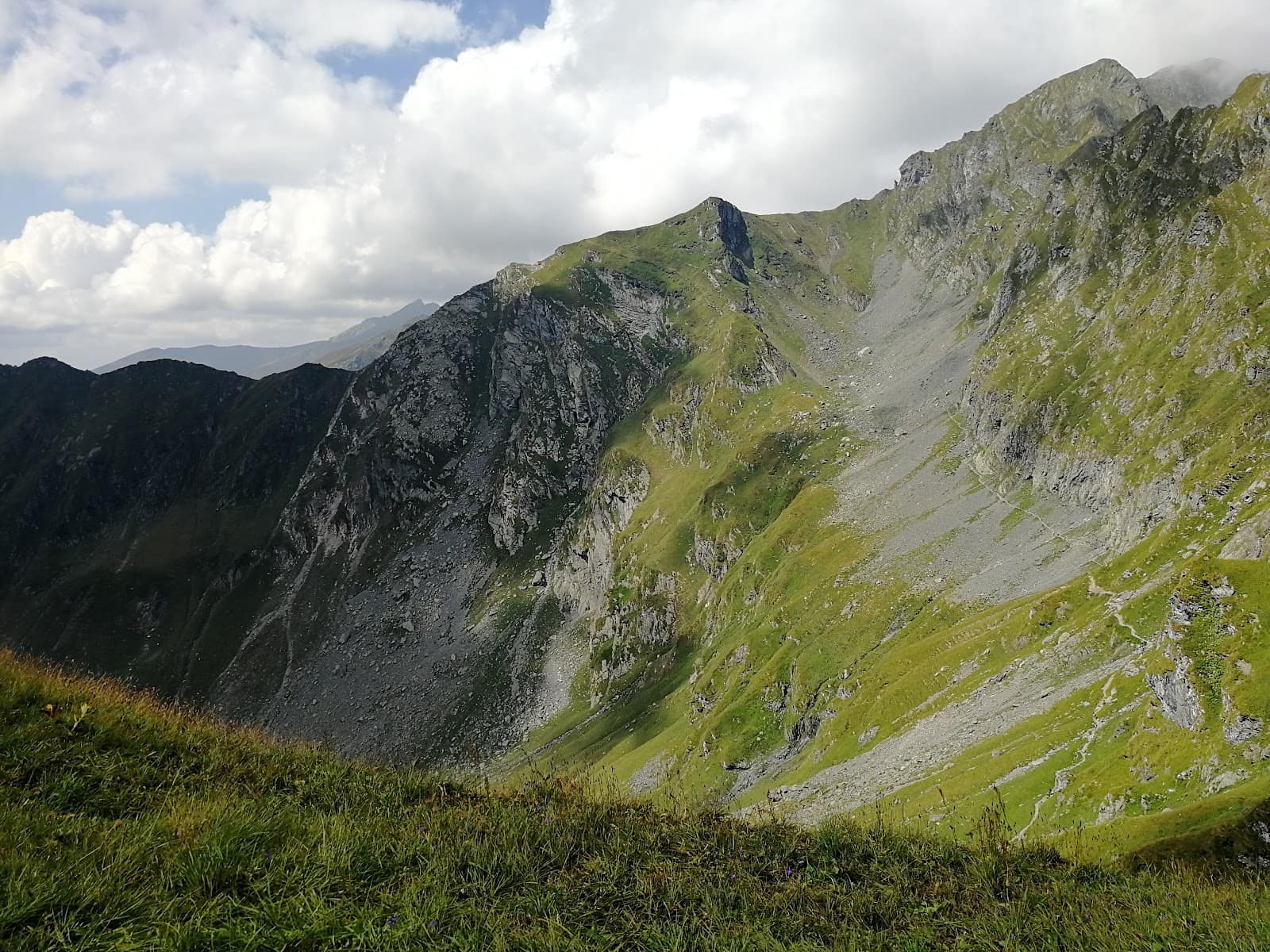
The main ridge runs broadly east–west across a chain of summits that rarely drops below 2000 m between them. That changes the whole logic of the route compared with a single peak: you don't climb once and descend, you stay high for days at a time, with descent options that are scarce and sometimes long. The hourly times you'll find in other sources are indicative only — your real pace depends on pack weight, the state of the path after rain, and how long the technical sections cost you.
Most complete traverses take 5–7 days, but the line also lends itself to shorter 2–3 day sections, precisely because access through the side valleys allows intermediate entries and exits. Many hikers do a pilot section before attempting the full traverse.
Why it's considered hard
- Exposure. There are airy passages where a slip is unforgiving; the best known is Strunga Dracului, below Negoiu, a steep rocky corridor that demands free hands and a clear head.
- Sustained altitude. Prolonged walking above 2000 m tires you differently from a day hike, and overnight recovery is slower.
- Isolation. Help does not come fast. Phone signal is patchy, and an injury high on the ridge can mean many hours before rescue arrives.
- Weather that turns in minutes. Ridges draw storms; you are the highest point in the landscape, and therefore the lightning target.
For all these reasons, the Făgăraș Ridge is not a beginner's route. It demands alpine terrain experience, sure footing and familiarity with multi-day pack hiking.
Access points
The most convenient entry marker is Bâlea Lake, at 2034 m, easily reached in summer by car on the Transfăgărășan or by cable car from the valley when the road is closed. From here you can attack the ridge either eastward (toward Negoiu and on to Moldoveanu) or westward, depending on your plan.
On the northern slope, the classic access valleys — Bâlea, Doamnei, Sâmbăta and others — climb from the lowland up to the ridge on waymarked paths. On the southern slope, access from the reservoirs and the wilder valleys is longer and less frequented. Whichever end you choose, plan your entry and exit at points where getting back to the car is realistic; many hikers close the loop with a pre-arranged car transfer.
Direction of travel
There is no universally "correct" direction. Starting from Bâlea, you have the advantage of beginning high, without the effort of gaining all the elevation from the valley. The trade-off is that you leave Moldoveanu for the end, when your pack is lighter but your legs are tired too. Read the forecast and schedule the exposed passages for the good-weather windows.
Cabins, refuges and camping
On the Făgăraș Ridge you sleep in metal refuges, at a few mountain cabins and, where permitted and sensible, in a tent beside the glacial lakes. The refuges are simple, unheated and run on a first-come basis; do not treat them as a reservation. Plan stages that leave you a fallback if the target refuge is full or the weather stops you earlier.
Simple rules that save your trip: 1. Start early. Cross the summits and exposed passages in the morning, before the afternoon storms. 2. Don't schedule stages to the limit. Leave a margin for fog, wind or a minor injury. 3. Leave a trace. Tell someone your exact route and estimated finish time each day.
Water on the ridge
Water is the most underestimated problem of the traverse. High on the line the springs are rare and seasonal; you rely on the glacial lakes and the streams running down from the cirques. By late summer, many sources dry up. In practice this means you plan your stages around where you can refill, not just where you can sleep.
Carry enough reserve for the long waterless ridge sections and treat surface water (filter or tablets). A dehydrated hiker makes mistakes on the technical passages — water here isn't comfort, it's safety.
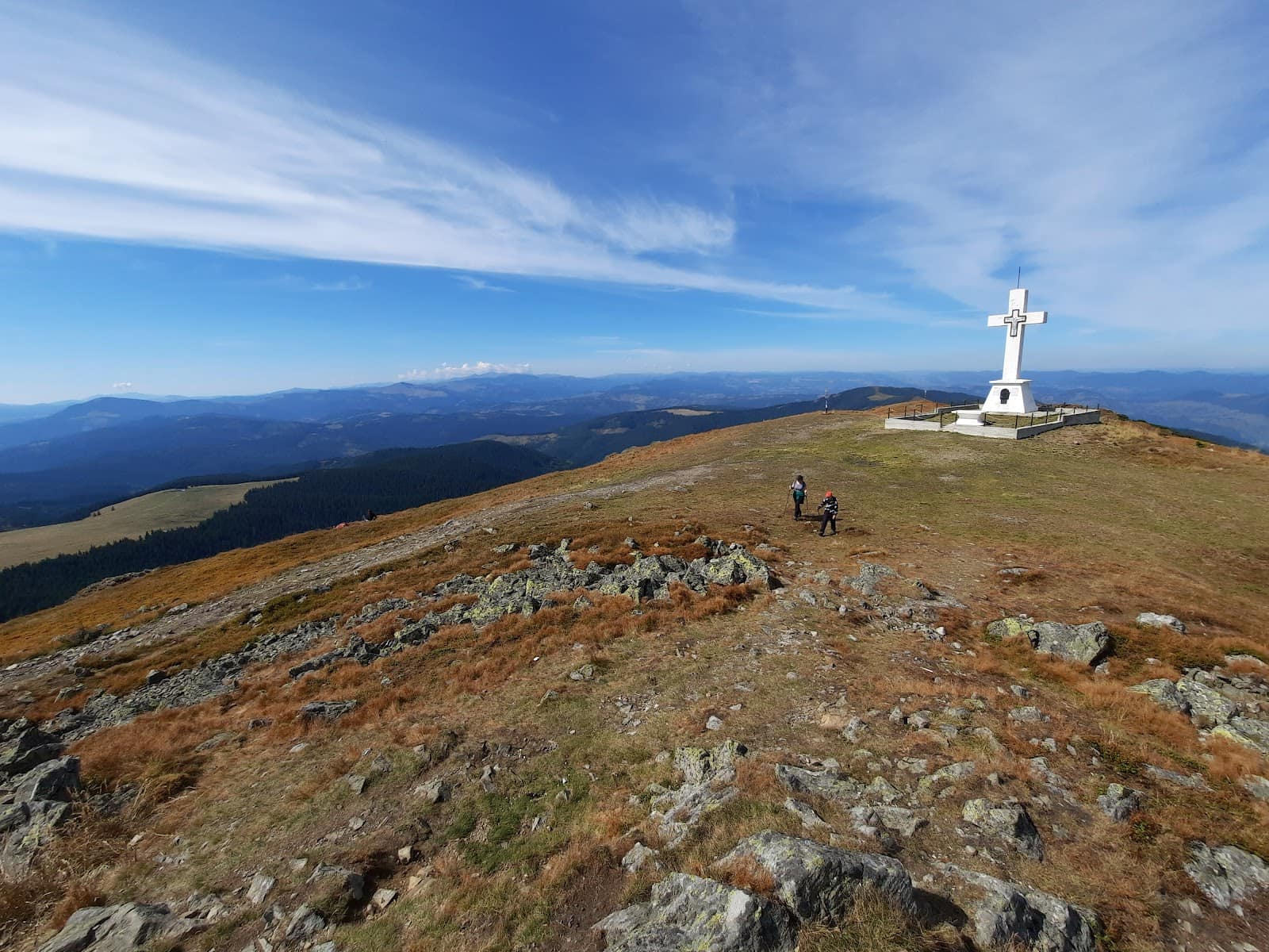
The main summits
Moldoveanu, 2544 m, is the highest point in Romania and usually appears toward the middle-to-end of the full traverse, as a side objective off the main line. Reaching it involves a small detour and a secondary ridge.
Negoiu, 2535 m, is the second-highest peak and, for many, the technical crux of the trip. Near it lies Strunga Dracului, an exposed passage you treat with maximum seriousness; in strong wind, ice or poor visibility, bypassing or turning back are wise decisions, not a failure.
Between these two peaks runs a long string of summits above 2000 m, each with its own glacial cirque and character. The beauty of the traverse lies precisely in this unbroken succession of height.
The best season
The realistic window for the full traverse is July to September, when the snow has melted off the exposed passages and the refuges are accessible. In early summer, snow tongues can linger on the northern slopes and in the notches, which completely changes the difficulty — a walking passage becomes one that demands an ice axe, crampons and the experience to use them.
Early autumn brings more stable weather and fewer crowds, but the days are shorter and the nights cold. Outside this window the ridge enters a winter alpine regime and is no longer the subject of this guide. Always check the mountain weather forecast the day before and every morning.
Escape routes
A mature traverse is planned with the exits worked out in advance, not improvised when needed. The northern valleys — Bâlea, Sâmbăta, Doamnei and the rest — offer descents toward the lowland; on the southern slope the exits are longer. Before the trip, note for each stage the nearest descent option and a rough estimate of how long it would take.
Legitimate reasons to retreat: a storm with lightning, dense fog on exposed passages, injury, exhaustion, or a dried-up water source that breaks your plan. There is no shame in going down; the shame is in forcing an exposed passage in bad weather.
In an emergency, call 112 and ask for Salvamont (mountain rescue). Memorize this before you leave, don't go looking for it when you already need it.
Essential gear
The traverse calls for multi-day gear, not a stroll's kit. For the full list, read our mountain hiking gear guide; in short, for the ridge what matters is:
- Stiff boots, with ankle support and a sole that grips wet rock.
- A complete shell system (waterproof hardshell + fleece) — the weather can break at any time.
- Your own shelter: a sleeping bag rated below freezing, a mat, and a tent if you won't rely on refuges.
- Water and a treatment method, plus reserve for the dry sections.
- Navigation: map, compass and an offline app; don't rely on signal.
- A headlamp with spare batteries, a first-aid kit, an emergency blanket.
- Trekking poles to spare your knees on the long descents.
Before any big trip, re-read our mountain safety and weather guide. If you want context on the other major ridges, the Piatra Craiului Ridge is next on the list of anyone who does Făgăraș.
Frequently asked questions
How long does the Făgăraș Ridge traverse take?
Most full traverses take 5–7 days, but the line also allows 2–3 day sections via the side access valleys. The times you see on maps are indicative: your real pace depends on pack weight, path conditions and the weather. Plan stages with a margin, not to the limit.
Is the Făgăraș Ridge dangerous?
It has seriously exposed passages, the best known being Strunga Dracului below Negoiu, plus sustained altitude and isolation. It is not a beginner's route and demands alpine experience, sure footing and familiarity with multi-day trips. In bad weather, turning back is the right call.
When is the best time for the traverse?
The realistic window is July to September, once the snow has melted off the exposed passages. In early summer, snow tongues can remain that demand an ice axe and crampons. Always check the mountain weather forecast the day before and every morning.
Where do I find water on the ridge?
You rely on the glacial lakes and the streams in the cirques; springs on the line itself are rare and dry up toward late summer. Carry reserve for the long waterless sections and always treat surface water with a filter or tablets.
Can I climb Moldoveanu and Negoiu without doing the whole ridge?
Yes. Moldoveanu and Negoiu can also be reached by slope routes, climbing and descending in the same day or with one overnight, without the full traverse. Many people do these peaks separately first and only then attempt the traverse.